Municipal Powers, Land Use Planning, and the Environment: Understanding the Public’s Role

Municipal Powers, Land Use Planning, and the Environment: Understanding the Public’s Role
Exploring the nature of citizens’ rights to participate in municipal decisions related to the environment
The Issue / Idea
What is the nature of citizens’ rights to participate in municipal decisions related to the environment?
The Project
Municipalities exercise a broad range of powers that have significant direct and indirect impacts on the environment. Alberta’s cities, towns, and rural municipalities are already key players in waste management, water and wastewater treatment, and land use planning and development. They have the authority to assume a greater role in the regulation and management of natural areas including wetlands, air and water quality, toxic substances, redevelopment of contaminated lands, water conservation, wildlife, and other aspects of the environment within the municipality.
This Guide outlines the legal rights of citizens to participate in decision making on issues related to the environment. The Guide also provides approaches citizens can take in participating in municipal decisions.
It is important to note that there have been some amendments to the Municipal Government Act since this guide was published in 2005. These amendments may have implications for certain aspects of public participation. See the ELC website for further updates on the Municipal Government Act changes.
Municipal Powers, Land Use Planning, and the Environment: Understanding the Public’s Role

Organization
This project was undertaken by
The Environmental Law Centre
Status
Completed in
2005
Supporters
Alberta Law Foundation
Renewable Energy for Rural Municipalities

Renewable Energy for Rural Municipalities
A project to help municipalities municipalities understand their environmental, social, economic concerns and opportunities, and what support tools they may need to process applications for large scale (over 1MW) solar and wind development in their municipality
The Issue / Idea
What tools do municipalities need to balance development considerations with high value agricultural, ecological, and cultural lands?
The Project
“By 2030, renewable sources like wind and solar will account for up to 30 per cent of electricity generation,” says Alberta’s Climate Leadership Plan.
To achieve this goal, large scale wind and solar developments are being proposed and are likely to have direct impacts in rural jurisdictions that have the land base to support them. In discussions with several municipal staff, it has become apparent they are uncertain how renewable electricity regulations and development will affect them. What is their role in the regulatory and approvals process? How do they balance competing interests between agriculture, ecology and renewable development? What do they need to know to make informed decisions?
Miistakis is working with municipalities to understand their environmental, social, economic concerns and opportunities, and what support tools they may need to process applications for large scale (over 1MW) solar and wind development in their municipality. Miistakis will then collaborate with stakeholders to develop the support tools required to inform decision making at the local level.
Renewable Energy Development: Ecological Fact Sheet for Municipalities

Renewable Energy Development: Regulatory Resources for Municipalities

Rural Municipal Wind and Solar Decision Support Tools: Regulatory Context Background Paper

Survey Report: Large Scale Wind & Solar Decision Support Tools for Rural Municipalities Project

Rural Municipalities and Renewable Energy Development: Education Session (January 23, 2018, Brooks, AB)

Rural Decision Support Tools for Renewable Energy Development: Progress Update (Miistakis Institute)
Organization
This project was undertaken by
Miistakis Institute
Status
Completed in
2018
Supporters
Alberta Association of Municipal Districts and Counties
Wheatland County
Municipal Land Use Suitability Tool (MLUST)

Municipal Land Use Suitability Tool (MLUST)
A project to help municipalities identify where renewable energy (and other land uses) is most suitable in consideration of high valued
agricultural, ecological, and cultural lands
The Issue / Idea
How do municipalities balance development considerations with high value agricultural, ecological, and cultural lands?
The Project
When municipal governments consider industrial scale solar or wind energy development, it immediately becomes clear that not everywhere is suitable for those activities, and not everywhere is unsuitable. For some areas it is a clear-cut ‘yes’ or ‘no’, but most areas sit somewhere on a continuum between those two extremes.
The Miistakis Institute and the Oldman River Regional Services Commission (ORRSC) developed the Municipal Land Use Suitability Tool (MLUST) to assist the municipalities in identifying where renewable energy development is most suitable in consideration of high valued agricultural, ecological and cultural lands.
The MLUST process has been conducted for the Municipal District of Pincher Creek and the Municipality of Crowsnest Pass. For each municipality, the process took six months to complete and engaged municipal stakeholders, made use of existing spatial datasets, and produced a series of map products to inform planning at the municipal scale.
MLUST engaged the municipal council and staff to identify features they valued on the landscape. Each feature was scored by stakeholders to determine each features conflict with wind and solar energy development. The most suitable areas for renewable energy development coincided with low probable conflict rating of other land uses. Renewable energy development suitability areas were also informed by removing No-Go Areas based on provincial, municipal and organizational regulations and Non-Development Areas based on existing settlement and Infrastructure.
The MLUST process can be adapted to determine the most suitable lands for any type of land use, not just renewable energy.
Prior to the development of the MLUST process, a similar process was used with Wheatland County and the County of Newell called the Least Conflict Lands. This process was later refined to create the MLUST process.
Municipal Land Use Suitability Tool (MLUST) for Municipality of Crowsnest Pass

Executive Summary: Municipal Land Use Suitability Tool (MLUST) for Municipal District of Pincher Creek

Municipal Land Use Suitability Tool (MLUST) for Municipal District of Pincher Creek

Executive Summary: Least Conflict Lands: Municipal Decision Support Tool for Siting Renewable Energy Development

Least Conflict Lands: Municipal Decision Support Tool for Siting Renewable Energy Development

Organization
This project was undertaken by
Miistakis Institute
Oldman River Regional Services Commission
M.D. of Pincher Creek
Wheatland County
County of Newell
Status
MLUST Crowsnest Pass Completed in
2021
MLUST Pincher Creek Completed in
2020
Least Conflict Lands Completed in
2018
Supporters
Energy Efficiency Alberta
Rural Municipalities of Alberta
The INTACT Foundation
Energy Efficiency Alberta’s Community Energy Capacity Building Program
Wheatland County
County of Newell
Modelling Developable Lands in a Municipality

Modelling Developable Lands in a Municipality
A Planning tool to inform discussions around future development proposals and conservation planning facing municipalities today
The Issue / Idea
Municipalities are faced with development pressure on a continuous basis. How do they balance development considerations with conservation priorities?
The Project
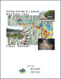
The Developable Lands Planning tool was created to inform discussion around future development proposals and conservation planning facing the Municipality of Crowsnest Pass, Alberta. The tool overlays a series of user-selected map layers, then models them against ‘development considerations’ and ‘conservation priorities.’ Adjustments were done in real time in a multi-stakeholder workshop environment to help participants understand the consequences of various development strategies.
Developable Lands Planning One Pager

Developable Lands Mapping Tool Final Report
Organization
This project was undertaken by
Miistakis Institute
Status
Completed in
2006
Supporters
Municipality of Crowsnest Pass
Nature Conservancy of Canada
Rural Community Economic Development Program through the Crowsnest Pass Business Development Corporation and the Western Economic Partnership Agreement
Call of the Wetland
Call of the Wetland
A citizen science amphibian monitoring project to understand the health of Calgary’s wetlands and to engage Calgarians in urban wildlife and wetland awareness
The Issue / Idea
How can municipalities learn about their urban wetlands’ health while engaging residents in wetland awareness?
The Project
To better understand the health of Calgary’s wetlands, Miistakis Institute, Enbridge, Parks Foundation Calgary, Alberta Conservation Association and the Calgary Zoo developed “Call of the Wetland”, a citizen science program that enabled the public to monitor amphibians as an important indicator of wetland health. There were 6 amphibian species that have historically been found in Calgary, however, prior to Call of the Wetland, it was unknown which still persist in our urban environment.
Call of the Wetland engaged Calgarians in understanding the health of wetlands through monitoring of amphibians and enabling a connection to nature in the City. The long term outcome of Call of the Wetland is to build off of the knowledge gained on amphibian presence to understand the health of wetlands within the City of Calgary, as well as to continue to foster a community of knowledgeable citizens to champion wetland protection and restoration.
Call of the Wetland Story Map

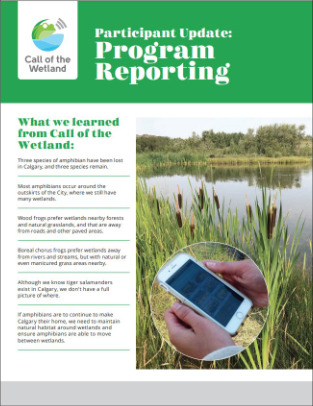
Call of the Wetland Participant Update: Program Reporting

Call of the Wetland Website

Amphibians at Risk: An analysis of wetland habitat and corridors needed to secure amphibian populations in Calgary

Amphibians At Risk In Calgary: Infographic

Organization
This project was undertaken by
Miistakis Institute
City of Calgary
Calgary Zoo
Alberta Conservation Association
Status
Completed in
2020
Supporters
Enbridge
Parks Foundation Calgary
The Calgary Foundation
Alberta Ecotrust Foundation
Alberta Innovates
TD Friends of the Environment Foundation
Bow River Basin Council
Mount Royal University
Mount Royal University, Institute of Environmental Sustainability
STAR EcoWorks
World Wildlife Fund Canada
Urban Wildlife Monitoring

Urban Wildlife Monitoring
A citizen science monitoring project to understand how wildlife responds to the urban environment, and to engage Calgarians in urban wildlife awareness
The Issue / Idea
How can municipalities learn about their urban wildlife populations while engaging residents in wildlife awareness?
The Project
Calgary Captured is a multi-year urban wildlife monitoring program that was launched in 2017 focused on medium to large mammals. Through citizen science, the program involved Calgarians in biodiversity monitoring through the classification of camera-trap images to species. The objectives of the program are to build a dataset of species presence in Calgary, engage Calgarians in urban wildlife awareness, and to improve our understanding of how wildlife responds to the urban environment.
Calgary Captured Year One Analysis: Technical Report

Calgary Captured Year Results

Calgary Captured Year One Results: Maps

I’m A Calgarian

(example of one of six wildlife awareness cards produced)
Calgary Captured Information Card

(example of one of five Calgary Captured awareness cards produced)
City of Calgary: Wildlife Camera Monitoring

Organization
This project was undertaken by
The City of Calgary
The Miistakis Institute
Alberta Environment and Parks
Friends of Fish Creek Provincial Park Society
Weaselhead/Glenmore Park Preservation Society
Status
Began in 2017 and is
On-going
Supporters
The Calgary Foundation
Alberta Ecotrust Foundation
TD Friends of the Environment Foundation
Working with Nature

Working with Nature
Harnessing the power of natural infrastructure to increase municipalities’ flood and drought resiliency
The Issue / Idea
Every municipality has “natural infrastructure,” but what is it, where is it, and how does it relate to flood and drought risk?
The Project
The Working With Nature toolkit was created to help municipalities catalogue their natural infrastructure, and then develop a prioritized plan for better using it to mitigate flood and drought risk. A Primer document was developed to provide a starting point for municipalities to understand the type of information, data, and programs available to inform and support flood and drought mitigation planning.
This free toolkit provides the materials and directions for a municipality to self-navigate through workshops, worksheets, and ultimately a living Workbook. In the process, a municipality will address Goals and Principles, Risks and Hazards, Natural Infrastructure, Actions, and Policy Development.
Working with Nature Toolkit Website

Working with Nature Webinar Slide Deck

Municipal Flood and Drought Action Planning Primer

Adapting to Flooding: An Adapt-action Summary Report

Adapting to Water Scarcity: An Adapt-action Summary Report

Organization
This project was undertaken by
The Miistakis Institute
Status
Project was completed in
2019
Supporters
Government of Alberta’s Watershed Resiliency and Restoration Program
Town of Cochrane
Urban Wetland Connectivity

Urban Wetland Connectivity
A project to help maintain amphibian diversity and increase amphibian abundance in the urban environment
The Issue / Idea
How can municipalities support urban amphibian populations?
The Project
The goal of this project was to provide information to The City of Calgary to help maintain amphibian diversity and increase amphibian abundance in the urban environment. Three amphibian species, wood frog (Lithobates sylvaticus), boreal chorus frog (Pseudacris maculata) and tiger salamander (Ambystoma mavortium) currently make Calgary their home. Key concerns for amphibians in Calgary are the impacts of wetland loss, wetland degradation, and fragmentation of the wetland network. We sought to understand which wetlands support amphibians and where amphibians are moving between wetlands in Calgary.
The modelling products include habitat suitability indices, connectivity models, and centrality and barrier maps designed to inform planning, management and restoration of the wetland network to support amphibians in Calgary. For this project, natural wetlands, modified wetlands and stormwater ponds were all included in modelling and are referred to in this report generically as wetlands.
Amphibians at Risk: An analysis of wetland habitat and corridors needed to secure amphibian populations in Calgary
Amphibians At Risk In Calgary: Infographic
Organization
This project was undertaken by
The Miistakis Institute
The City of Calgary
The Calgary Zoo
The University of Saskatchewan
Status
Completed in
July 2020
Supporters
Alberta Innovates
Municipal Environmental Purpose

Municipal Environmental Purpose
A white paper to catalyze discussion on the new municipal purpose ‘to foster the well-being of the environment’, introduced in Alberta’s revised Municipal Government Act of 2017
The Issue / Idea
How do municipalities consider the revised Municipal Government Act’s (2017) added a new purpose for municipalities: to foster the well-being of the environment?
The Project
The well-being of Alberta’s natural environment is heavily dependent on decisions made at the municipal level. The overhaul of the Municipal Government Act (MGA) recognized this with a new purpose for municipalities: “ to foster the well-being of the environment.” However, there was no accompanying policy direction as had been the case with other revised elements of the Act.
Since that time, several municipalities have begun trying to interpret this new purpose in varied ways, risking the creation of isolated and inconsistent approaches. This paper is intended to be an initial step to better understanding the implications of this significant change in the MGA.
While the literature offers little insight into the concept of “well-being of the environment”, there was clearly an intent behind this phrasing, so it is therefore worthwhile understanding the three critical elements – foster, well-being, and environment – informed by definitions, common usage, and associated legislation.
It is significant that the inclusion of ‘well-being of the environment’ in the Municipal Government Act was codified as a municipal purpose inserted immediately after the “good government” purpose, suggesting it should be interpreted more pervasively than the specific ‘service, facility, safety, and viability’ purposes.
Even with definitional clarity, municipalities are still challenged with understanding how decision-making processes would be affected. The authors suggest a common set of process characteristics be clearly reflected in municipal policy or decision rationale: Due Consideration, ‘Two Roads’ Assessment, Proactive Approach, Measured and Evaluated, and Liability Mitigation. Undertaking this approach would have the benefits of reinforcing current efforts, supporting regulatory alignment, enabling innovation, and increasing clarity and accountability.
Recognizing it would not be possible to comprehensively describe all discrete decision making circumstances, but that greater direction is needed, the authors suggest ‘categories’ based on the wellbeing of the environment powers in the Big City Charters.
Implementation of the well-being of the environment purpose will need to be embedded in municipal governance and regulatory frameworks, including bylaws, plans, policies, strategies, and measurements, with tool choice dependent on the specific environmental application or media.
More work is now needed to clarify the environmental decision-making areas affected (or created) by this new purpose, and to offer pragmatic direction for municipalities with regard to implementation. That work prerequires a broader conversation amongst municipalities to come to some consensus, and high level policy direction from Municipal Affairs.
BRIEF: ‘TO FOSTER THE WELL-BEING OF
THE ENVIRONMENT’:
INTERPRETING ALBERTA
MUNICIPALITIES’ NEW PURPOSE

‘TO FOSTER THE WELL-BEING OF
THE ENVIRONMENT’:
INTERPRETING ALBERTA
MUNICIPALITIES’ NEW PURPOSE

Organization
These assessments were undertaken by
The Miistakis Institute
The Environmental Law Centre
Status
Completed in
2019
Supporters
The Miistakis Institute
Municipal EcoToolkit: Tools for Maintaining your Natural Systems

Municipal EcoToolkit: Tools for Maintaining your Natural Systems
A resource for Alberta municipalities seeking to maintain their natural infrastructure systems
The Issue / Idea
How can a municipality maintain their natural infrastructure?
The Project
The Municipal EcoToolkit was created by the Miistakis Institute as a resource for Alberta municipalities seeking to maintain their natural infrastructure systems. It is not intended to be a prescriptive statement on what must be done. It is intended to help generate awareness, creativity, collaboration, and questions, and assist those people doing the challenging work of maintaining our natural systems.
To make this toolkit, we focused in such things as law/bylaws, policy directives, inventories or datasets, protective designations, maps, management constraints, proactive strategies, staff positions, guidelines, legal designations, education/communication resources, workshops, case studies, financial analyses, technologies, restorative actions, etc., etc. ..!
Municipal EcoToolkit Website

Organization
This project was undertaken by
The Miistakis Institute
Status
This research was completed in
2020
Supporters
Alberta Innovates
Environmental Law Centre
Alberta Low Impact Development Partnership