Municipal Powers, Land Use Planning, and the Environment: Understanding the Public’s Role

Municipal Powers, Land Use Planning, and the Environment: Understanding the Public’s Role
Exploring the nature of citizens’ rights to participate in municipal decisions related to the environment
The Issue / Idea
What is the nature of citizens’ rights to participate in municipal decisions related to the environment?
The Project
Municipalities exercise a broad range of powers that have significant direct and indirect impacts on the environment. Alberta’s cities, towns, and rural municipalities are already key players in waste management, water and wastewater treatment, and land use planning and development. They have the authority to assume a greater role in the regulation and management of natural areas including wetlands, air and water quality, toxic substances, redevelopment of contaminated lands, water conservation, wildlife, and other aspects of the environment within the municipality.
This Guide outlines the legal rights of citizens to participate in decision making on issues related to the environment. The Guide also provides approaches citizens can take in participating in municipal decisions.
It is important to note that there have been some amendments to the Municipal Government Act since this guide was published in 2005. These amendments may have implications for certain aspects of public participation. See the ELC website for further updates on the Municipal Government Act changes.
Municipal Powers, Land Use Planning, and the Environment: Understanding the Public’s Role

Organization
This project was undertaken by
The Environmental Law Centre
Status
Completed in
2005
Supporters
Alberta Law Foundation
Renewable Energy for Rural Municipalities

Renewable Energy for Rural Municipalities
A project to help municipalities municipalities understand their environmental, social, economic concerns and opportunities, and what support tools they may need to process applications for large scale (over 1MW) solar and wind development in their municipality
The Issue / Idea
What tools do municipalities need to balance development considerations with high value agricultural, ecological, and cultural lands?
The Project
“By 2030, renewable sources like wind and solar will account for up to 30 per cent of electricity generation,” says Alberta’s Climate Leadership Plan.
To achieve this goal, large scale wind and solar developments are being proposed and are likely to have direct impacts in rural jurisdictions that have the land base to support them. In discussions with several municipal staff, it has become apparent they are uncertain how renewable electricity regulations and development will affect them. What is their role in the regulatory and approvals process? How do they balance competing interests between agriculture, ecology and renewable development? What do they need to know to make informed decisions?
Miistakis is working with municipalities to understand their environmental, social, economic concerns and opportunities, and what support tools they may need to process applications for large scale (over 1MW) solar and wind development in their municipality. Miistakis will then collaborate with stakeholders to develop the support tools required to inform decision making at the local level.
Renewable Energy Development: Ecological Fact Sheet for Municipalities

Renewable Energy Development: Regulatory Resources for Municipalities

Rural Municipal Wind and Solar Decision Support Tools: Regulatory Context Background Paper

Survey Report: Large Scale Wind & Solar Decision Support Tools for Rural Municipalities Project

Rural Municipalities and Renewable Energy Development: Education Session (January 23, 2018, Brooks, AB)

Rural Decision Support Tools for Renewable Energy Development: Progress Update (Miistakis Institute)
Organization
This project was undertaken by
Miistakis Institute
Status
Completed in
2018
Supporters
Alberta Association of Municipal Districts and Counties
Wheatland County
Municipal Land Use Suitability Tool (MLUST)

Municipal Land Use Suitability Tool (MLUST)
A project to help municipalities identify where renewable energy (and other land uses) is most suitable in consideration of high valued
agricultural, ecological, and cultural lands
The Issue / Idea
How do municipalities balance development considerations with high value agricultural, ecological, and cultural lands?
The Project
When municipal governments consider industrial scale solar or wind energy development, it immediately becomes clear that not everywhere is suitable for those activities, and not everywhere is unsuitable. For some areas it is a clear-cut ‘yes’ or ‘no’, but most areas sit somewhere on a continuum between those two extremes.
The Miistakis Institute and the Oldman River Regional Services Commission (ORRSC) developed the Municipal Land Use Suitability Tool (MLUST) to assist the municipalities in identifying where renewable energy development is most suitable in consideration of high valued agricultural, ecological and cultural lands.
The MLUST process has been conducted for the Municipal District of Pincher Creek and the Municipality of Crowsnest Pass. For each municipality, the process took six months to complete and engaged municipal stakeholders, made use of existing spatial datasets, and produced a series of map products to inform planning at the municipal scale.
MLUST engaged the municipal council and staff to identify features they valued on the landscape. Each feature was scored by stakeholders to determine each features conflict with wind and solar energy development. The most suitable areas for renewable energy development coincided with low probable conflict rating of other land uses. Renewable energy development suitability areas were also informed by removing No-Go Areas based on provincial, municipal and organizational regulations and Non-Development Areas based on existing settlement and Infrastructure.
The MLUST process can be adapted to determine the most suitable lands for any type of land use, not just renewable energy.
Prior to the development of the MLUST process, a similar process was used with Wheatland County and the County of Newell called the Least Conflict Lands. This process was later refined to create the MLUST process.
Municipal Land Use Suitability Tool (MLUST) for Municipality of Crowsnest Pass

Executive Summary: Municipal Land Use Suitability Tool (MLUST) for Municipal District of Pincher Creek

Municipal Land Use Suitability Tool (MLUST) for Municipal District of Pincher Creek

Executive Summary: Least Conflict Lands: Municipal Decision Support Tool for Siting Renewable Energy Development

Least Conflict Lands: Municipal Decision Support Tool for Siting Renewable Energy Development

Organization
This project was undertaken by
Miistakis Institute
Oldman River Regional Services Commission
M.D. of Pincher Creek
Wheatland County
County of Newell
Status
MLUST Crowsnest Pass Completed in
2021
MLUST Pincher Creek Completed in
2020
Least Conflict Lands Completed in
2018
Supporters
Energy Efficiency Alberta
Rural Municipalities of Alberta
The INTACT Foundation
Energy Efficiency Alberta’s Community Energy Capacity Building Program
Wheatland County
County of Newell
Modelling Developable Lands in a Municipality

Modelling Developable Lands in a Municipality
A Planning tool to inform discussions around future development proposals and conservation planning facing municipalities today
The Issue / Idea
Municipalities are faced with development pressure on a continuous basis. How do they balance development considerations with conservation priorities?
The Project
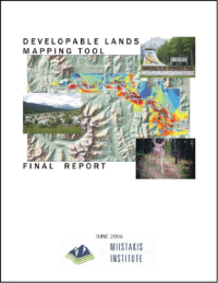
The Developable Lands Planning tool was created to inform discussion around future development proposals and conservation planning facing the Municipality of Crowsnest Pass, Alberta. The tool overlays a series of user-selected map layers, then models them against ‘development considerations’ and ‘conservation priorities.’ Adjustments were done in real time in a multi-stakeholder workshop environment to help participants understand the consequences of various development strategies.
Developable Lands Planning One Pager

Developable Lands Mapping Tool Final Report
Organization
This project was undertaken by
Miistakis Institute
Status
Completed in
2006
Supporters
Municipality of Crowsnest Pass
Nature Conservancy of Canada
Rural Community Economic Development Program through the Crowsnest Pass Business Development Corporation and the Western Economic Partnership Agreement
Urban Ecoroofs

Urban Ecoroofs
Exploring the impacts ecoroofs may have on climate change resilience in Alberta municipalities
The Issue / Idea
What impacts can ecoroofs have on climate change resilience in Alberta municipalities?
The Project
As cities develop, vegetation is typically replaced with non-permeable, non-vegetated surfaces. Ecoroofs are one way to provide some of the lost ecosystem services in urban centres including improved stormwater management (both quantity and quality), better regulation of building temperatures, reduced urban heat island effects, improved air quality, and increased urban wildlife habitat and biodiversity (Oberndorfer et al., 2007). Some jurisdictions refer to ecoroofs as a ‘no-regrets’ climate adaptation measure (Mees, Driessen, Runhaar, & Stamatelos, 2013) because they serve multiple societal goals.
Between 2017 and 2019, the Miistakis Institute partnered with the City of Edmonton, Environmental Strategies team to explore the impacts ecoroofs may have on climate change resilience in the city.
Ecoroof Guide for Municipalities

Ecoroof Fact Sheet

Edmonton Ecoroof Initiative for Climate Change Resiliency: Ecoroof Function Research

Jurisdictional Review
Edmonton Ecoroof Case Studies

Edmonton Ecoroof Website

Organization
This project was undertaken by
The Miistakis Institute
City of Edmonton, Environmental Strategies
Status
This project was
completed in 2019
Supporters
City of Edmonton
Alberta Ecotrust Foundation
Edmonton Community Foundation
Federation of Canadian Municipalities
Rural Residential Expansion Research

Rural Residential Expansion Research
Understanding and mapping rural residential expansion in southwestern Alberta
The Issue / Idea
What is the extent of rural residential expansion in southwestern Alberta?
The Project
In 2003, Miistakis published Spatial Analysis of Rural Residential Expansion in Southwestern Alberta. The report summarizes what we learned from analyzing half a century’s worth of municipal tax assessment data, and describes the patterns and possible drivers of exurban expansion in southwestern Alberta. The data and maps this project produced are some of our most frequently requested resources. In 2006, we revisited the original data in attempt to better understand the spatial distribution of this type of development. Our analysis suggests that rural residences are more likely to occur on sites with scenic views, and with close proximity to golf courses and urban centres. In 2011, Miistakis collaborated with Dr. Michael Quinn at the University of Calgary in an effort to update and expand the Rural Residential Data Set. Work was completed in early 2012, and we now have a complete historical record of more than a century of rural residential expansion for 12 Municipal Districts and Counties in southern and central Alberta.
Spatial Analysis of Rural Residential Expansion in Southwestern Alberta

Rural Residential Expansion in Southern Alberta

Mapping the Exurban Explosion: Rural Residential Expansion in Southwestern Alberta

Rural Residences Map Animation

Organization
This project was undertaken by
The Miistakis Institute
Status
Development of this report and dataset began in 2003 and was
updated and completed in 2012
Supporters
Alberta Ecotrust
Alberta Environment
Henry P. Kendall Foundation
University of Calgary
Alberta Summer Temporary Employment Program
Informing Urban Ecosystem Management

Informing Urban Ecosystem Management
A literature review and case studies to inform urban ecosystem management, prepared for the City of Calgary, Urban Conservation
The Issue / Idea
How are cities using an urban ecosystem management approach?
The Project
The goal of this research is to support the revision of the City of Calgary’s Natural
Areas Management Plan (NAMP) with findings from relevant literature and case studies, based on the evolving nature of urban ecosystem management. Because the mandate of the Urban Conservation portfolio is city-wide, this research is also intended to support the development of an urban ecosystem management approach for the City of Calgary.
The authors identified two key goals and associated research objectives:
- Ensuring a scientific rationale exists to support an ‘urban ecosystem management’ approach for the City of Calgary; and
- Ensuring a basis exists for translating ecological management principles into asset management approaches.
For both, the research approach included reviews of peer-reviewed and grey literature, relevant case studies, analogous jurisdictions, and relevant organizations and resources. There was no intent at this stage to deeply analyze the research nor provide management recommendations.
Informing Urban Ecosystem Management: Literature Review and Case Studies

Organization
This project was undertaken by
The Miistakis Institute
Status
This research was completed in
December 2016
Supporters
City of Calgary
Ecological Values Mapping

Ecological Values Mapping
Providing a visual representation of a municipality’s collective community and conservation values
The Issue / Idea
How does a community accurately map and communicate its most important values?
The Project
In 2007, concerned over mounting development pressure and threats to the landscape and traditional lifestyle of the region, the MD Ranchland approached the Miistakis Institute to help them identify community and conservation values that are important to the MD, and then to map these values as accurately as possible.
Through an open and inclusive process, Miistakis worked with the MD staff, council and residents to identify these values and then express them in a spatial/GIS context. The same methodology could easily be applied to different municipalities, and would be expected to result in the identification of different values.
MD Ranchland – Community & Conservation Values Mapping Project – Phase III Report

One Pager and Previous Phases

Community and Conservation Values Mapping


Organization
This project was undertaken by
The Miistakis Institute
Status
Phase I – data scoping completed in 2007; phase II – mapping tool and user guide completed in 2009; Phase III – enhanced mapping and communication support report completed in 2011
2011
Supporters
Municipal District of Ranchland
Alberta Municipal Affairs’ Municipal Sustainability Program